The Midnight Ride of Rob McMurray
18 September 2016 • by bob • Bicycling, Arizona
So, I went out for a late-night ride on my mountain bike last night... I left the house around midnight, and my route took me through some of the desert on the northeast side of Tucson.
FYI - It's a little unnerving when a whole pack of coyotes starts sounding off near you when you're by yourself with nothing but a single headlight to keep your bike on the narrow path. Just sayin'...
Perhaps a midnight ride wasn't my best idea.
PS - The coyote image is from Michael Frye, who has even more amazing artwork on his website.
How One Jerk Ruined MapMyFitness For Me
08 August 2016 • by bob • Bicycling, Rants
As you may have seen from several of my earlier posts, I'm a big fan of recreational road cycling. Over the past few years I have ridden thousands of miles, and I have blogged about several of the "Century Rides" in which I have participated. During the average month I love climbing on my bicycle and riding through the surrounding desert three or four times per week.
Earlier this year I had shoulder surgery, and cycling became an important part of my recovery program. When my doctor and physical therapist both said that it was okay for me to start riding again, I spent several painful weeks working through the shoulder pain and slowly increasing my mileage, but it was ultimately worth the effort.
That being said, I also like to track my rides on the MapMyFitness website, and over time a playful competition developed between myself and a few of the other riders on some of my favorite desert courses. I am too old to be a serious competitor, so I was always a few minutes behind the fastest riders. But I usually rode more often than a few of the other riders, and therefore I was able to earn enough points to maintain my standing.
However, earlier this year someone moved to town who - for some inexplicable reason - decided that he needed to cheat.
On the one hand, this makes no sense to me: the MapMyFitness website is supposed to be about tracking your health, so why anyone would want to cheat seems beyond my comprehension.
On the other hand, some people like to compete with each other, as I mentioned earlier about myself and a few others on the MapMyFitness website. And where there's competition, some people like to win - regardless of what it takes to do so.
All of this leads me back to the cheater. What this guy likes to do is ride several of the courses with several cycling GPS devices and upload the results from all of his devices to the MapMyFitness website. I wasn't aware of this before, but the MapMyFitness website is poorly-designed in such a way that it allows people to do this, so it doesn't bother to check if a person is uploading multiple rides for the same course at the same time. This seems like a pretty trivial thing to check, so it was amazing to me just how easy the MapMyFitness website made cheating possible.
Needless to say, once this guy started uploading his fraudulent ride data, it became impossible to compete with him. I usually rode one of my favorite courses twice each time that I rode, and this guy would ride the same course two or three times. But since he was uploading the data from three GPS devices, the MapMyFitness website was giving him credit for six or nine rides. At that point it didn't matter how many times that I rode each course - there was no way that my honesty would be able to keep up with his dishonesty.
Now you would think that the folks at MapMyFitness would care about this, so a few months ago I decided to bring this to their attention. Here's what I sent them:
I have been a member of MapMyFitness for several years now, and an MVP member for some time. To be honest, from a workout tracking perspective, MapMyFitness has a lot of stiff competition from Strava, Ride With GPS, Garmin, etc. There is one reason why I chose MapMyFitness over its competitors - and that is for the friendly competition with other members. Over the past couple years, a few members have competed with me for Guru and Sprint King on a few of the MapMyFitness courses, and the opportunity to challenge or be challenged by someone else has created fun and attainable goals for me to strive for. This has been especially beneficial for me recently because I spent the latter part of last year and the early part of this year recuperating from surgery due to a series of cycling accidents last year, and the challenge of competition got me back on my bicycle again. As I mentioned earlier, this spirit of competition is specifically the reason why I chose MapMyFitness over its competition, and why I became an MVP member.
However, over the past few weeks I have realized just how easy it is for someone else to cheat, and as a result it has become apparent that honest behavior on my part will never achieve the numbers that someone who is being deliberately deceitful can attain. While I realize that MapMyFitness cannot actively police all of the activities that its users post, I think some things are easy enough to detect. Consider the following workouts from one person in question:
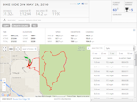 |  | 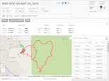 |
It is readily apparent that this user is uploading the same workout from three different Garmin devices, so each time that he completes a course his numbers are multiplied by three. With that in mind, on days when he has completed some of the courses in our area more than once, his numbers are simply unattainable by anyone who doesn't resort to his methods of dishonesty. Following my surgery I can barely make it 20-25 miles before I have to quit for the day, so there is no way that I could ride the 90-100 miles that I would need to ride in order to overcome this person's deceit.
As I mentioned earlier, I realize that MapMyFitness is more or less on an 'Honor System' and it cannot actively police all of the activities which are uploaded, but it would be easy to detect this specific user's behavior by simply checking if any user is in a course more than once at the same time; when that happens, do not count one of the courses.
Unfortunately, I also realize that my complaint will likely fall on deaf ears, and as a result I will probably cease using MapMyFitness in the near future. Since the one feature for which I chose your service is apparently suffering from unchecked fraudulent behavior, I feel that am left with little alternative. Thankfully, as I mentioned earlier, there are other choices available to me.
To be honest, I did not expect a response, so I was surprised to hear back from them. However, the banal substance of their response was ultimately worse than hearing nothing:
Kyle (Help & Support)
Hi Robert,
Thank you for writing in about this.
We have a system in place for identifying users that circumvent the rules on both challenges and courses. Sometimes, these are missed and certain users are able to manipulate the system, but we actively monitor and check leaderboards and challenges for cheating. We appreciate you reporting this to us and I have passed this along to the appropriate team.
Cheating participants will not be awarded prizes.
Let me know if you have any additional questions or concerns
Thanks,
Kyle
It may sound like I'm being overly harsh to what seems like a polite response, but the truth is - the scammer rocketed to the top of the leaderboard on several courses, and MapMyFitness didn't do anything about it. The year is barely half over, and this fraudster has already amassed scores which cannot possibly be attained by anyone who refuses to stoop to his level of deception.
So I used to look forward to the friendly competition on the MapMyFitness website, but now that's something of an impossibility. No matter what any honest person does, they simply cannot compete with this schmuck. It's amazing how all it takes as one jerk to ruin something.
A Hot Time in the Park Today
13 July 2016 • by bob • Bicycling, Arizona
So, today's ride through Saguaro National Park was a little warm... ![]()

Of course, the highest temperatures were when I was climbing Riparian Ridge... That was no fun at all, believe me.
Snakes in the Lane
26 May 2016 • by bob • Bicycling, Arizona
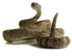
I saw a four-foot rattlesnake in the bicycle lane during one of my cycling laps around Saguaro National Park today, and I'm not quite sure how I feel about that.
On the one hand, he's not riding a bicycle; but on the other hand, he's not in a motorized vehicle.
I think he gets by on a technicality.
Cycling Perspectives
03 May 2016 • by bob • Bicycling, Arizona
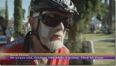
I was watching a video about last year's 104-mile El Tour de Tucson cycling event, when they interviewed the guy in this photo...
This cyclist is 86 years old, and he was riding the full 104 miles as he has done every year for the past 33 years.
![]()
I have officially lost every opportunity for whining about how hard that ride was for me...
PS - Bonus points for this guy's cycling jersey from the 160-mile Ride Around Mount Rainier in One Day.
El Tour 2015 - The Day After
22 November 2015 • by bob • Bicycling, Arizona
I posted the following to Facebook, but I thought that it would be good to repost here...
How I spent my Saturday - riding 104 miles around the city of Tucson with 9,000 other people from around the world. This year I abandoned my usual habit of riding for time and I tried to simply have fun with it. Sure, it took me a lot longer than last year, but this year I didn't want to sell my bike when I was done...
2015 El Tour de Tucson
Ride Notes for El Tour de Tucson 2015
21 November 2015 • by bob • Bicycling, Arizona
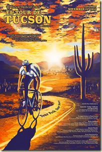
A year has passed since my last adventure riding in the El Tour de Tucson, so it was time for this year's ride. 2015 marked the 33rd anniversary of this annual event, and once again I signed up to ride the full 104 miles. If I was going to subtitle this years ride, I would call it "The Ride That Almost Wasn't," but I'll explain what I mean by that a little later.
 |  |
This year there were a couple of big differences from my ride last year, the biggest of which was that I rode with my friend Kevin, with whom I had recently ridden the 100-mile Cool Breeze Century. Kevin and I had been discussing the ride over the past few weeks, and I have been riding with a different philosophy - ride to have fun.
This may sound strange, but for the longest time I had been hating my rides. Seriously - I hated all of them. Of course, that is an untenable situation for someone who wants to be a recreational cyclist, so I had to figure out what was wrong with the way that I was riding. After some self-examination, I determined that my problem was simply that I was always racing the clock on each ride, and I was always trying to outdo my previous time. So a couple of months ago I decided to stop racing the clock, and I discovered that I was enjoying [sic] my rides a little more.
With that in mind, Kevin and I agreed to ride at a comfortable pace, and to stop for more of the Support and Gear (SAG) stops along the way. That being said, the El Tour de Tucson is an extremely well-supported ride with SAG stops every 5 or 6 miles, so we had plenty of opportunities to rest and refuel.
One of the bright spots about this year's weather was that it promised to be warmer than last year, which was literally freezing before the race started.

The 104-mile race starts at 7:00am, but seeing as how neither Kevin nor I wanted to race the clock, we agreed to meet at the starting point at 6:15am. (That was a whole lot better than last year when I got in line around 5:00am.) I woke up early, double-checked my pre-race cycling checklist, packed the last of my gear into the car, and headed across town to meet Kevin. As I drove across town I could see that the weather seemed to be pretty close to predictions, which meant that I wasn't going to freeze this year. (That was great news.)

I made it across town in short order, and I pulled into the parking lot at the Tucson Convention Center (TCC) shortly after 6:00am. TCC is near the starting line and has ample parking for lots of participants, so several cyclists were getting their gear ready as I parked and started to prep my gear for the day. I had loaded all of my equipment onto my bicycle, and as I was putting on the last of my cycling clothing I made a horrific discovery: I was missing my cycling helmet. (This is why I referred to this day's race as "The Ride That Almost Wasn't.")
Wearing a helmet is always a good idea, but in this specific instance it was imperative; the race mandates that all riders wear a helmet in order to participate. I mulled over my options, and I did a quick estimate to determine how long it would take me to drive home, pick up my helmet, and drive back. I might have been able to get home and back by the 7:00am start time, but as I was deliberating what to do, Kevin called me. I explained the situation, and after he had a good laugh at my expense, Kevin said that he could wait for me to get back before starting. I mentioned that the timing chips on our race placards do not start until we physically cross the start line, so starting a few minutes late might not be that big of a deal.
However, as the two of us talked, I saw that Kathleen was trying to call me, so I put Kevin on hold and answered Kathleen's incoming call. She found my helmet lying on the counter, and she was asking if she should bring it to me. Thankfully Kathleen already needed to be on that side of Tucson around 7:00am, so the two of us set up a place to meet somewhere near the start line. Once Kathleen and I hung up, I switched back to my call with Kevin, and I explained the arrangements to him. Kevin said that he would wait for me near the start line for me, then I locked up my car and pedaled over to Kevin's location.
After Kevin and I met, the two of us rode over to the place where Kathleen and I had agreed to meet, and she arrived around 6:40am. She quickly handed off my helmet, (see the following photo), then Kathleen headed off to her appointment while Kevin and I got in line for the race. (Note: I'm wearing a lot of cold weather gear in the following photo, but as the day grew warmer I slowly removed all of my cold weather gear.)

It was already 6:45am by the time that Kevin and I got in line, so we were understandably pretty far in the back. But still, neither Kevin nor I wanted to race, so our place in line meant little to either of us.

An unintended bonus from my earlier debacle meant that Kevin and I didn't have long to wait when we got back in line. (Which was a good thing since the temperature had dropped to 39 degrees.) After everyone had sung the National Anthem and a few kind words were spoken by the event dignitaries, the ride officially began at 7:00am. It took several minutes for the back of the line to start moving, but once we began to roll everything progressed in an orderly fashion, and we were on our way.

Here's a time-lapse video from the Arizona Daily Star of the race start; Kevin and I are in there somewhere... (We're on the far side of the street at 1:13, but good luck finding us!)
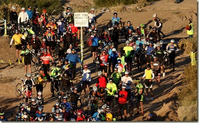
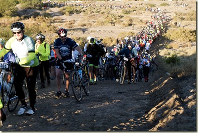
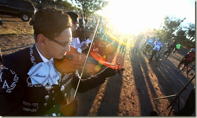
A little over a half-hour into the ride we hit our first adventure of the day - crossing the Santa Cruz River, which was thankfully dry this year. Nevertheless, it's always amusing to see hundreds of cyclists hand-carrying their bicycles across the dry riverbed. Although one of the best parts of this experience it is always the Mariachi band on the far side of the river.
 |
 |
 |
Kevin and I rode through southeast Tucson along with the thousands of other cyclists who were participating in the 104-mile course, and yet we were able to ride close enough together to carry on a conversation as pedaled our way through the first several miles of the race. We met a lot of interesting people along the way, too. One of my favorites was a nice guy from the FBI who was riding his first century ride; we met up with him on the Houghton Road climb and East Escalante Road, (which are the last parts of a difficult climb to the highest point of elevation and we dropped him).
Thankfully I train on the east side of town all the time, so I ride Houghton Road and East Escalante Road several times a year. Another great part about hitting the highest point of the ride is that we get to ride downhill for several miles on Freeman Road.
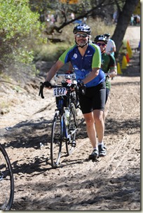
About 3½ hours into our trek we reached the half-way point of the ride, which is also the second river crossing. We also took this as an opportunity for a short break, so we rested up, refilled our water bottles, and ate a few snacks. After that, we were back on our bicycles.
 |  |
The next obstacle on our ride was the steepest climb of the day - East Snyder Road near North Rockcliff Road. Although it's the steepest part of the course, it is also thankfully one of the shortest climbs - perhaps only 200 meters or so. (But still, every year dozens of riders have to walk their bicycles up the hill. Neither Kevin nor me, though. Hehe.)
There's not much to say about the next couple hours of riding; we took advantage of a few rest stops, one of which was serving Eegee's frozen drinks. (Those were totally worth stopping for.) Once again - I hated the ride up La Cañada Drive, though.
 |  |
When we were around 10 miles or so from the end, Kevin asked me how close we were to my time from last year, to which I replied, "Last year I had already finished the ride an hour and a half ago." (That seemed somewhat demoralizing for Kevin.) Nevertheless after 8¼ hours we rode across the finish line, and my second El Tour de Tucson was over.
 |  |
| Kevin and I riding towards the finish line. | |
Ride Stats:
- Primary Statistics:
- Start Time: 7:02am
- Distance: 104 miles (103.5 miles on my GPS)
- Duration: 8 hours, 17 minutes (6 hours, 58 minutes on my GPS)
- Calories Burned: 3,502 kcal
- Altitude Gain: 3,209 feet
- Speed:
- Average Speed: 14.8 mph
- Peak Speed: 31.8 mph
- Average Cadence: 78.0 rpm
- Temperature:
- Average: 65.6 F
- Minimum: 35.6 F
- Maximum: 95.0 F
- Heart Rate:
- Average: 143 bpm
- Maximum: 175 bpm
When I arrived home, I posted the following synopsis to Facebook: "How I spent my Saturday - riding 104 miles around the city of Tucson with 9,000 other people from around the world. This year I abandoned my usual habit of riding for time and I tried to simply have fun with it. Sure, it took me a lot longer than last year, but this year I didn't want to sell my bike when I was done... "
UPDATE: A few months after the ride, one of our local television stations put together the following video. There's a bit too much advertising from several of the corporate sponsors, but apart from that it gives a good overview of the event.
The Italian Job VIII
02 November 2015 • by bob • Humor, Bicycling
My friend and fellow cycling enthusiast Keith shared the following security camera footage from the good folks at Woodinville Bicycle which captures the hilarious antics of a would-be thief attempting to steal a bicycle... I think we have a future Darwin Award recipient in the making.
Ride Notes for Cool Breeze 2015
15 August 2015 • by bob • Bicycling
Today I completed the Cool Breeze Century in Ventura, CA, which was organized by the Channel Islands Bicycle Club (CIBC). This century ride was billed by the CIBC as: "102 miles with about 4000 feet of climb - moderately challenging, [and] excellent for 1st time centurions." This was my fourth century ride within the past nine months, and despite its advertised status as an excellent ride for "first-time century riders," I think it was one of the more-difficult long distance rides that I have done.
I participated in this century ride with my good friend Kevin, who lives in the Los Angeles area. Kevin told me a few weeks ago that he had signed up for this ride, and at the last minute I invited myself along. Since I live in Arizona, however, this meant that I had to endure a ten-hour drive through the desert to LA on the day before the ride. Nevertheless I met up with Kevin in Ventura on the night before the ride, and we put together our plans for the next day.
We both got up early as planned, and I drove the two of us to the starting point near the Ventura Unified School District offices, where we arrived around 6:15am. (We were one of the last cars to get a great spot in the main parking lot.) We quickly pulled into a parking space, and then Kevin and I put together the last of our things for the day's ride. After a few minutes of deciding what to bring and what to leave, we headed off toward the starting line around 6:30am. In keeping with the spirit of this ride as a "non-race event," there was very little fanfare at the starting line - we simply rode past a set of banners with dozens of other cyclists and we were off.
 |
| Prepping the last of our gear for the day. |
 |
| Last-minute selfie before heading out. |
 |
| Approaching the starting line. |
I should point out before I go any further that I immediately appreciated how well-marked the route was throughout the day; there were route signs everywhere for the duration of the ride. (This was a great improvement over some other rides where you periodically wondered if you had accidentally left the route.) All of the route signs were emblazoned with color-coded arrows that matched the cue sheet that cyclists were given when they registered, so as long as cyclists followed the correctly-colored arrows throughout the day, they were going the right way. One discrepancy that Kevin and I noticed was that the cue sheet that we had been given only listed 97 miles for the length, which was five miles shorter than the 102 miles that was advertised for the ride. I told Kevin not to worry - I had my Garmin GPS with me, and we could use it to verify the ride length when the time came.
For the first 2.5 miles our route ran south along highway 33 in Ventura, but soon after that we were riding west along the beach trail by the ocean, which was great; this section of the course was what I thought a ride through California should be.
We were nine miles into the ride and cruising nicely along the beach when I suddenly heard a "Klank! Klank! Klank!" from immediately behind me. My initial thought was that something had fallen off my bicycle, but then I realized that the sound was coming from my rear wheel. I pulled to a stop, and after a quick examination I determined that my bike had broken a spoke. I have no idea how it happened; I didn't ride over anything like a branch that could get tangled up in my spokes - apparently it just snapped. It took me a few minutes of wrangling to bend the broken spoke into a position that would allow me to extricate it from my wheel, but I eventually managed to wrench it out and we quickly got back on the road. (Although I could hear the spoke nipple rattling around inside my rim for the rest of the ride.)
 |
| Kevin and I passing a photographer at 7:30am. (Note that this single photo represents the only time that we saw photographer during the ride.) |
We were a little over an hour and 15 miles into the ride when we reached our first stop of the day, which was at Rincon Beach Park. After a quick ten-minute break to refill our water bottles, Kevin and I got back on the road.
Our route took us north and inland as we left Rincon Beach Park, which kept us away from the water for the next eight miles or so. Over the next mile or so we faced our first climbs of the day, which were relatively short and nothing too difficult to worry about. After a few climbs and descents, we were mostly riding downhill as we rode to the west for the next few miles.
That being said, before the ride I studied the profile on the Ride with GPS website, which the ride organizers were kind enough to share online. With that in mind, I knew that we were rapidly approaching the most-difficult climbs for the day. Apparently I was not the only cyclist to have studied the course in advance, because shortly after we passed the 25-mile mark we faced the first serious climb and several cyclists loudly remarked, "Oh - this is the hill."
I'll be honest - this climb was moderately difficult, and thankfully it only lasted for a couple of miles or so. At one point or other, both Kevin's and my bicycles threw their chains when shifting from the large chain ring to the small chain ring, which was exceedingly frustrating. Thankfully each of us was wearing black shorts for the ride, because black shorts always afford a great place to wipe off all the bicycle grease from your hands once you have reseated your chain. (See #14 and #8 and in The Rules.) I should mention that one of the times when Kevin's bike threw its chain during a climb, Kevin did a masterful job of avoiding having to fall down with the bike. Many other people (including me) probably wouldn't have been able to prevent the fall, and several nearby riders remarked, "Nice save!"
After we had reached the summit for this set of climbs, we were treated to three miles or so of downhill riding, which was a great change of pace. Unfortunately, I knew that these few moments of physical respite would be brief; having studied the ride profile, I knew that the next part of the course was going to be the most-difficult segment of the ride.
One we had descended back to sea level and rode west along the ocean for a half-mile or so, we turned inland again and began a one-mile climb to the north and our second stop of the day at the 31-mile point around 9:00am in Manning Park. This stop is actually situated during the difficult part of the ride, so it's well-located for cyclists because it gives them a moment to rest up before tackling the really challenging climbs ahead.
 |
| Scores of cyclists in Manning Park. |
 |
| Resting my bike near the park fence. |
 |
| Refueling and bicycle maintenance stations. |
While Kevin and I were taking a break, we both refilled our water bottles, and I quickly ate a half a banana (for the potassium), a half-sandwich (for the carbs and protein), and a cookie (for the sugar). After a little over a half hour, we were sufficiently rested and refueled, so we climbed back on our bicycles and rode off to the north and into the toughest part of the course.
For the next two miles we faced steep climbs that ascended several hundred feet into the hills above Santa Barbara, where we slogged our way through neighborhoods filled with luxurious mansions overlooking the city. I will freely admit, the climbs were often steep, and they seemed to keep going on forever. We turned west as we continued to climb, and for the next eight miles it seemed that whenever we thought that we were finally beginning our descent we would round a corner and discover another climb was waiting for us.
 |
| This future site of somebody's mansion will have an awesome view. |
 |
| Posing for a useless photo. |
 |
| Dozens of narrow, hairpin turns during the climbs. |
I wear a heart rate monitor while I ride that is paired with my Garmin GPS, and occasionally it beeps at me when my heart rate is too high; e.g. over 170bpm. Usually I ignore it, because it's generally just a momentary spike in my pulse during a difficult moment or two, so eventually the beeping will go away on its own. But during this part of the ride it began beeping at me, and it wouldn't stop. After a few minutes I decided that it was best not to ignore it, so I told Kevin that I needed to pull over for a couple of minutes. As we pulled to the side of the road, my GPS showed that my hear rate was a little over 170bpm, but after five minutes' rest it came back down to 140bpm and we got back on the road. One other thing, I found it a little difficult to breathe during a few of the climbs, which I attributed to a lack of proper time to acclimate before starting this ride. (I had only arrived the day before, and I'm used to riding at an altitude that is 3,000 feet higher. When I rode in the Seattle to Portland ride a few weeks ago, I had a week to acclimate and enough time to get in a training ride.)
There is an old adage that states, "All Good Things Must Come to an End," and thankfully the same can be said about bad things. With that in mind, somewhere before we hit the 40-mile mark we had finally made it through the truly-difficult sections of the ride and we began our descent into Goleta. We encountered small climbs here and there over the next ten miles or so, but nothing as difficult as the major climbs that we had just completed. As we passed the 50-mile point of the ride, both Kevin and I had to suffer through some lower leg cramps, but nothing unbearable.
We pulled into our next stop at Stow Grove Park around 11:30am, which represented the mid-way point for the ride at 51-miles. Kevin and I refilled our water bottles, then we headed over to the dining area to grab some lunch. Once again I had a half-sandwich (for carbs and protein), a half a banana (for potassium), and few cookies (for sugar).
 |
| Resting my bike against a railing. |
 |
| Picking up lunch. |
 |
| Simple fare for simple minds. |
 |
| Cookies and fruit!!! |
 |
| More cookies!!! |
During lunch Kevin and I were seated across a table from three ladies, and I made several jokes with everyone about classic songs that I had been rewriting in my head during the day's ride:
- Sung to the tune of "Safety Dance":
"We can pass if you want to,
We can leave your friends behind.
'Cause your friends can't climb, and if they can't climb -
Well they're no friends of mine." - Sung to the tune of "Hotel California":
"Welcome to the Cool Breeze California,
Such a tiring race, such a grueling pace.
You'll question your mind at the Cool Breeze California:
I'm no competitor; why'd I register?" - Sung to the tune of "Margaritaville":
"Climbing the hills again in California,
Wondering why I'm still here at all.
Some people say that there's a friend I can blame,
But I know - it's my own dang fault."
My re-written version of "Margaritaville" drew an especially large chuckle from everyone, because I followed that up by mentioning how the pain of endurance riding passes over time, and then next thing you know you're inviting people along with you for your next excursion by saying things like, "Hey - you should sign up for this century ride with me; it's going to be lots of fun." At which point two of the ladies quickly turned and pointed at the other member of their party, who responded, "Yup - I'm the guilty one in our group."
After a 50-minute break Kevin and I headed back to our bicycles. As we prepped our gear for the next half of the ride, I met a cyclist who was wearing a jersey from the Paris-Brest-Paris (PBP) randonneuring ride, which is a 1200-kilometer (≈745-mile) endurance ride in France. (Which - by way of coincidence - was starting this same weekend.) The two of us chatted for a couple of minutes, and he admitted that he had ridden the PBP four times, but he was now too old to survive riding 250 miles a day for three days (with only four hours of sleep per day). I admitted that I was probably never young enough to have survived the ride.
As we left Stow Grove Park, our route had us backtrack to the east for three miles or so before zig-zagging for the next few miles in a mostly-southern direction through Hope Ranch towards the ocean.
For the next three or four miles we rode eastward and parallel to the beach, although much of that riding was through residential areas so we only saw the water occasionally. (That being said, a lot of the mansions that we were riding past were pretty amazing; it must be nice to be that rich, but couldn't that opulent wealth be better spent? [Deep sigh.])
As we rode into downtown Santa Barbara, we turned toward the ocean again, and we cycled along the water past a series of beaches, parks, and marinas. As we passed the entrance to Santa Barbara Harbor, Kevin suddenly had a flat. The two of us worked on the flat, and we managed to get it sorted out in a few minutes. (I was obviously taking photos at the time, but I actually helped Kevin fix his flat. Seriously. I really did. I promise.)
 |
| Santa Barbara Harbor was pretty nice. |
 |
| Fixing a flat. No fun. |
 |
| The beach near Santa Barbara Harbor and Stearns Wharf. |
After we got back on the road, we passed the ladies with whom we had met during lunch earlier in the day. As we pulled up to a stoplight, I mentioned that we had stopped to fix a flat, and I asked why they hadn't stopped to help us out; to which one of them replied humorously that it was every man and woman for themselves. As we approached another stoplight a short time later, some @#$% motorist unnecessarily blocked the bicycle lane even though the light was green, thereby causing all of us cyclists to quickly pull to a stop in order to avoid an accident. One of the ladies issued an appropriate expletive at the clueless driver, and I remarked that I completely agreed with her assessment of the situation. She replied by asking if I had a song in mind that expressed that sentiment, and I said that I could put anything to music - even that.
We rode east along the water for another three miles before turning inland to the north. After another two miles of riding and a short climb we arrived back at Manning Park around 2:30pm. This park had been our second stop of the day, and I thought that it was pretty ingenious that the ride's organizers had managed to arrange the ride in order as to recycle some of the stops. (Great logistics.) We refilled our water bottles and ate a few snacks, and then Kevin took advantage of the bicycle repair facilities to make sure that his tube repair was sufficient for continuing the ride. (The guy was able to discover a couple of places where the bead for Kevin's tire had not been seated completely, and he was able to fix that.)
 |
| Back at Manning Park. |
 |
| Pausing to refuel for the next segment of the ride. |
 |
| Kevin having his bike checked out. (That's just good sense.) |
We got back on the road after the bike technician had signed off on Kevin's bike, where we continued to ride east and parallel to the beach for several miles. We started our final climb somewhere around the 80-mile mark, but to be honest it wasn't much of a climb. That being said, my bicycle decided to throw it's @#$% chain again, so we had to stop for me to fix it again.
Nevertheless, my chain was an easy fix, and we were quickly back on the road. After a couple of miles we ran into a brief moment of confusion with a small gaggle of cyclists about whether our route really meant to take us onto the highway, which it did. Once we had ridden a few hundred meters, we had arrived back at Rincon Beach Park around 3:50pm, which was our final stop for the day at mile 82. (You may recall that Rincon Beach Park had been our first stop of the day, so once again the ride's organizers had managed to recycle one of the stops.)
The main claim to fame for riders who make it to the final stop at Rincon Beach Park is - popsicles. I had heard about this feature before we started the ride, and I must admit - an ice-cold popsicle tastes pretty good after a long day of cycling.
After a 25-minute stop to rest and recharge, Kevin and I climbed back on our bicycles for the last segment of the ride. The next 12 miles had us riding along the beach again, which was great. At some point about ten miles from the end of the ride I changed cycling techniques so that I was only pulling up on the pedals. I do this occasionally in order to allow some of the muscles in my lower legs a brief respite from my normal riding, but on this occasion my change in technique was met with a sudden and sharp cramp in my inner right thigh. This was painful enough for me to loudly and angrily remark, "Oh crap!", and I drifted off to the right side of the bike lane as I desperately tried to stretch out the affected muscles while still riding. Kevin overhead my exclamation and asked if everything was okay, and I responded that I would be fine in a moment or two. I eventually managed to work my way through the pain, but still... that really hurt.
Shortly after we hit the 94-mile point we turned northward into Ventura as we retraced the 2.5-mile route that had started the day's ride. As we approached the Ventura Unified School District offices where the finish line was located, a cycling couple quickly pulled off the bike path several hundred meters from the end of the route. As Kevin and I rode past I remarked, "You can't quit now!" However, after Kevin and I had ridden few hundred meters further, my Garmin GPS showed that we were going to reach the finish line after having ridden only 97 miles, so I told Kevin that we needed to pull to the side.
I mentioned that if we crossed the finish line, we weren't going to make 100 miles; however, we both wanted to officially claim this as a "Century Ride,", which meant that we needed to add three miles to the length. I proposed that we create a quick loop through Ventura and Kevin agreed, so we bypassed the finish line and headed off into areas of Ventura that weren't on the scheduled route. After a little over a mile we merged back onto the official course, and as we headed toward the finish line I remarked that we were still going to be short by a little less than half a mile, so we bypassed the finish line and rode off in a different direction. As we approached the point where I wanted us to turn around, we bumped into the cycling couple that we had seen earlier, and I remarked to them, "Oh - now I get it; you two wanted your official century ride, too!" They both laughed and said that yes - that's why they had bypassed the finish line, too.
As Kevin and I rode back toward the finish line, I could see that we were just going to make it, and as we pulled to a stop past the finish line my GPS showed that we had just crossed the century mark.
Once we had crossed the finish line, we rode over to my car, where we loaded all of our combined gear into the back and locked up our bikes on the bike carrier.
After we had all of our things stowed in the car, Kevin and I dropped by the registration area to take advantage of the dinner that was provided, then the two of us hopped in the car and drove back to Kevin's house for the night.
Ride Stats:
- Primary Statistics:
- Start Time: 6:35am
- Distance: 100 miles
- Duration: 7:09:34
- Calories Burned: 3,892 kcal
- Altitude Gain: 4,724 feet
- Speed:
- Average Speed: 14.0 mph
- Peak Speed: 30.3 mph
- Average Cadence: 80.0 rpm
- Temperature:
- Average: 73.6 F
- Minimum: 55.4 F
- Maximum: 104.0 F
(This is according to my GPS, but I find that hard to believe.)
- Heart Rate:
- Average: 148 bpm
- Maximum: 181 bpm
Epilogue and Miscellaneous Parting Thoughts
As I had done for my Seattle to Portland ride notes, I had jotted several things down that didn't necessarily apply to any part of the ride, so I thought that I would add a special section to this blog in order to share them.
- Based on advertising, I thought this ride was going to be peaceful cruise along the water with the cool breeze at our backs, but it was seldom like that. I realized from looking at the ride profile that the climbs were going to take us inland for several miles so I expected that, but what was unexpected (and somewhat disappointing) was that we sometimes rode parallel to the ocean for several miles without actually being able to see the water.
- We rode through Santa Barbara for quite a while, yet I never saw Gus or Shawn. But then again, I guess that they live in San Francisco now. (Inside joke.)
- It was rather warm during parts of the ride; as a result, several of the locals and some others complained, but the temperature was not bad for me.
- We completed this ride at a considerably slower pace than my normal rides, and somewhat slower than my previous century rides. But Kevin and I had agreed to take this ride at a comfortable pace; I specifically did not want to feel like I was racing a clock (which I normally do), and as a result the ride was more enjoyable [sic] than normal.
- Despite the advertised length of 102 miles with 4,000 feet of climb, the Ride with GPS website lists the length of this ride at 97 miles with a little over 5,000 feet of climb. That being said, my GPS agreed that the length of the ride was 97 miles, although my GPS said that the final altitude gain was closer to 4,700 feet. In either case, I think the CIBC guys were pretty far off.
- The fact that almost all of the difficult climbs were relegated to one segment of the course was a mixed blessing; it was nice to ride for dozens of miles over long, flat stretches of road, but the hours of actual climbing were exceptionally arduous since the bulk of the elevation gains were all in one small segment.
- As I mentioned in the notes, my bike threw its chain a few times during this ride. However, I managed to catch it quickly each time, so I avoided wiping out. After some experimentation, I determined that the problem seems to be when I am shifting chain rings at a high RPM; when I consciously slowed my cadence I was able to avoid throwing my chain. (But still - my bicycle should not be throwing the chain like that.)
- I had overlooked one unfortunate side effect of driving ten hours on the day before the ride: I had predominately used my right arm while driving cross country, and it was hurting by the time that I arrived in Ventura. Even though I took some Advil and tried to relax my arm during the night before the ride, I could still feel my right arm hurting during the ride as a direct result of the previous day's drive.
- I purchased a new saddle a couple of weeks before this ride, and I had not completely broken it in; so my derriere was understandably a little sore by the end of the ride. It was fine by the next day as I drove home, but still - I can honestly say that this ride was literally a pain in the... butt.
Ride Notes for July 22nd, 2015
22 July 2015 • by bob • Bicycling, Arizona
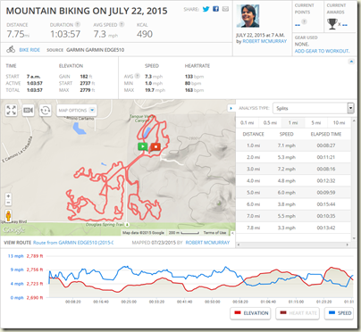
Today was a fun day of mountain biking with family members, at least for a little while. Here's the scoop: my wife's relatives were hosting a family reunion at the Tanque Verde Ranch at the base of the Rincon Mountains, (which is an awesome place), and one of the activities available to guests was an hour of Mountain Biking.
There were four of us who decided to go mountain biking today: my brother-in-law, Mike, and I are both road cyclists, so mountain biking sounded like it would be a little different from our usual routines; one of my nephews, Nate, likes to go mountain biking when he's back home in Washington state; and my son-in-law, Curt, is a fan of myriad outdoor activities (namely surfing).
We showed up at the cycling office at the ranch around 6:45am and met with Chuck, who was to be our guide for the day. After some basic fitting of cyclists to full-suspension mountain bike frames, we took off around 7:00am. Chuck took us through some easy trails at first to get everyone acclimated to their bicycles, then he navigated the group to a small track which the ranch has created on its property. The track is a small oval with lots of bumps and high-berm corners. Chuck had each of us make several passes around the track to get used to working with the full-suspension systems on the bicycles, and then we headed off into the desert.
Our route primarily consisted of extremely narrow paths between rows of cacti and other pointy plants, which kept everyone on their toes. At one point I had to mention to Curt that he shouldn't brush up against the cholla cactus, because they have a tendency to break off and painfully attach themselves to people. We also traversed a lot of small hills, and Chuck took us to one particular hill where everyone could jump off and get a little air under their bicycle.
After riding around for a while Chuck asked if we'd like to go on the harder trails, and everyone agreed; sometime around that decision the injuries started to happen:
The first mishap was when Curt flipped his bike trying to cross a small wash. (Note: Curt was wearing his GoPro camera at the time and managed to get that on video.)
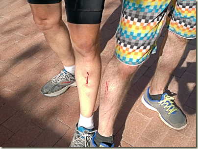
The later mishap occurred when we were climbing a hill over some rocks, and my left leg slipped off the pedal. Since I was pushing hard with my legs to climb the hill and over the rocks, this meant that I had nothing to slow the speed of my right leg as it pushed down hard on the remaining pedal, which spun the empty pedal around and smashed broad-faced into my left shin at full force. This hurt more than you can possibly imagine; I went from a 0 to 10 on the pain scale instantaneously, and I immediately formed two golf-ball-sized welts on my shin where the pedal collided with the bone. I quickly pulled to a halt, exclaimed something a little more dire than "Oh Crap," and it took me a couple of minutes to get myself together.
I walked my bike to where the rest of group was waiting and announced, "I'm done for the day." I explained what had happened, and by now the contusions on my leg were so large that everyone else thought that I had broken my leg, and the swollen areas were the bone jutting out. I assured everyone that my leg wasn't broken because I could put weight on it, but I didn't want to risk injuring it again, so my day of cycling was over.
We walked our bikes toward the ranch for a little bit, which was out of courtesy for me, but I informed everyone that it would be easier for me to ride than to walk. With that in mind, we boarded our bicycles and headed back to the shop at the ranch. Once we arrived, Chuck brought me a bag of ice and a crash kit, and I started to ice the swelling on my leg.
The following photo shows my injuries (on the left) and Curt's injuries (on the right); unfortunately the photo is from the front of my leg, so you can't see how high the swelling was at this point - all you can see are light shadows.
Once we had returned our bikes to the shop, we met the rest of the family for breakfast, where my wife - the nurse - took one look at me and asked something like, "So, where did you hurt yourself this time?" After breakfast I headed back to our room, and after a couple hours of icing my injuries the swelling had disappeared; all that remained was a nagging pain in my left leg when I walked.
All that being said, despite the injuries it was a fun time. And my injury serves to illustrate why riders should clip in when mountain biking.
Ride Stats:
- Primary Statistics:
- Start Time: 7:00am
- Distance: 7.8 miles
- Duration: 1:03:57
- Calories Burned: 490 kcal
- Altitude Gain: 182 feet
- Speed:
- Average Speed: 7.3 mph
- Peak Speed: 19.7 mph
- Temperature:
- Average: 85.4 F
- Minimum: 78.8 F
- Maximum: 87.8 F
- Heart Rate:
- Average: 133 bpm
- Maximum: 163 bpm


